 |
|
Archway - Tower Bank |
Chapel RowChapel Row stands on the northern edge of Craster, its front doors facing north, away from the village. The terrace runs at right angles from the sea and continues the line of the chapel itself. Joyce Shaw, whose family used to live on the Row, says that the five houses in the terrace were built after the Chapel by William Archbold, Bill 'Sailor', who built them for his five sons, none of whom actually went on to live on the terrace.
This photo shows the front of the terrace; the porches are more recent additions to the original design.
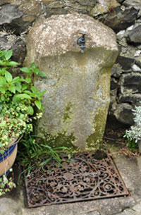
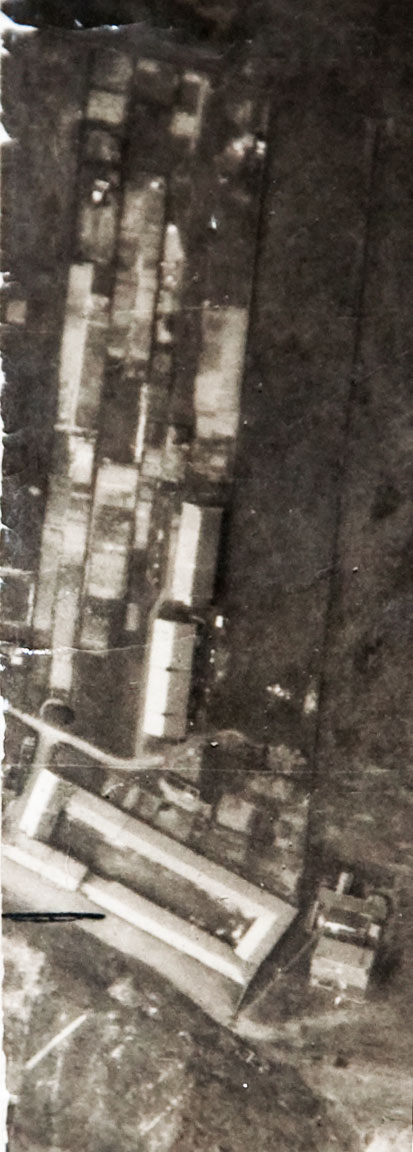
This photograph shows the standpipe behind Chapel Row. Joyce Shaw, remembers her family, who lived on Chapel Row, using the sandstone plinth to sharpen their knives. This probably accounts for the shaped edges of the plinth. The ornate wrought iron grid could be an original feature. For further information about Craster's old water system see 'Reservoir Tank'. The following image is taken from a larger photograph, which is made up of many separate images, cut and stuck together to make a coherent whole by Sir Ivan and Lady Sutherland, which extends from Craster to High Newton and from the sea to inland of Embleton. One of the images carries the following number, 106G/UK.24June'45.F/202//54.... Unfortunately the end of the number is covered by another part of the image and may continue for an unknown number of digits. The image shows the houses of Chapel Row, with the Methodist chapel above them and the Dunstanburgh Road smokehouse, now demolished, below.
|


 |
Home Programme Membership Archive War Memorials History Walk Miscellanea Links Contact Us